The offshore region south of mainland Portugal is sandwiched between the Eurasian and Nubian plates. Portugal’s numerous, active offshore faults in that region create most of the earthquakes recorded in mainland Portugal. But active faults exist also inside mainland Portugal, and they can generate quite destructive earthquakes. While many faults are well known, there are still many others that remain to be discovered and studied.
Specialists do not yet agree on which fault or set of faults caused the 1755 earthquake. If it were just a single fault, that fault must have been enormous! It may also have been two or more large faults rupturing in sequence. Historical information on the tsunami suggests that such faults must have been, when combined, 200 km in length and 80 km wide.
Throughout its history, Lisbon has been affected by many quakes, some of great magnitude and intensity. Plate deformation is very slow in our region, so earthquakes can occur at wide time intervals. This explains why we tend to forget earthquakes on a day-to-day basis, even though their effects can be overwhelming.
Magnitude is a measure of the seismic energy released on the fault as it moves abruptly. For older earthquakes, it is an estimated magnitude. Only since the mid- 20th century has magnitude been measured based on seismographic records.
Intensity is a measure of the severity of ground motion caused by the earthquake. It is estimated by analysing the effects that the vibration has on constructions, people and animals. From degree V of intensity onwards, damage begins to be observed, mainly in the most fragile constructions.
Did you know?
The Nubian and Eurasian plates draw closer to each other by 4-5 mm every year, converging south of mainland Portugal. That is about the length our nails grow in one month!
A strong quake hasn’t been felt in Lisbon since 1969… The next big one may happen anytime now!
In regions where the surface deforms slowly, like mainland Portugal and adjacent offshore regions, geologists are very conservative on the definition of active or possibly active faults. Faults are classified as active if they show evidence of deformation in the last 2 to 3 million years, that is, during the upper Pliocene or Quaternary.
The earthquake on 1 November 1755 in Lisbon is considered by many as the beginning of seismology as a science because it was the first event to be studied scientifically. The lead person was Marquês de Pombal, who ordered a detailed inquiry on the effects of the earthquake on the whole kingdom. However, only in the early 20th century did scientists finally understand how earthquakes are generated.
The fault that ruptured to generate the 1 November 1755 earthquake is estimated to have caused an average 20 m of displacement across the fault. This is the height of a 7 storey building! The Tohouku earthquake is known to have caused 40 m of slip in some areas of the fault, the height of a 12 storey building.

The 1 November 1755 Lisbon earthquake is considered by many as the beginning of seismology as a science because it was the first event to be studied scientifically. The lead person was Marquês de Pombal, who ordered a detailed inquiry on the effects of the earthquake on the whole kingdom. However, only in the early 20th century did scientists finally understand how earthquakes are generated.
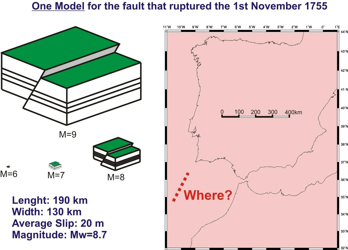
Historical information on the tsunami suggests that the fault, or set of faults, that generated the 1 November 1755 earthquake must have been 200 km in length and 80 km wide. This is a huge structure that Earth scientists are still looking for today. The fault must have ruptured the surface of the seafloor or very close to it because a destructive tsunami was generated.
Active faults that generate large tsunamis must rupture or deform the seafloor. One of the tools used by Earth scientists to identify these faults, like the one that generated the 1 November 1755 earthquake, is to build detailed maps of the seafloor topography. The sea bottom is shaped by tectonic activity, deposition of sediments,and erosion.
Continue Exploring
Bibliography
Cabral, J. (2012). Neotectonics of mainland Portugal: state of the art and future perspectives. Journal of IberianGeology, 38(1), 71-84.
Stucchi, M. et al (2013). The SHARE European earthquake catalogue (SHEEC) 1000–1899. Journal of Seismology, 17(2), 523-544.
Vilanova, S. P. et al (2014). Incorporating descriptive metadata into seismic source zone models for seismic‐hazard assessment: A case study of the Azores–West Iberian region. Bulletin of the Seismological Society of America, 104(3), 1212-1229